

Press & Publications
-
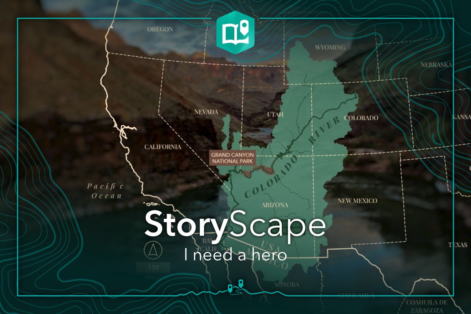
I Need A Hero
The February 2026 Issue of Esri’s StoryScape highlights stellar stories that feature a memorable hero and includes related instructional resources for our storytelling community. And Caught in the Middle is one of those stories! From the article: “ Specificity can help activate your readers' imagination, opening the door to curiosity and intrigue. Priming their readers by using the Colorado River Basin to examine the significance of land conservation, the authors then went further, providing stunning imagery and maps to make a lasting impact.“
Esri StoryScape, February 1, 2026
-

Esri Map Book, Vol. 40, 2025: Bicycle and Pedestrian Crashes, City of Durango Multimodal Transportation Plan
Four Corners designed all the maps for the City of Durango’s 2023 Multimodal Transportation Plan, which guides the implementation of projects to move Durango towards an integrated multimodal transportation network. My map, Bicycle and Pedestrian Crashes, aggregated crash data into a tessellated hexagonal grid, which allowed City planners to see at a glance where the highest frequency of each or both crash types occurred, identifying key intersections with frequent crashes, and showing that the main thoroughfare acts as an obstacle to multimodal traffic. It was published in the 2025 Esri Map Book Vol. 40 as a map that “clarifies he complexities of our world”.
-
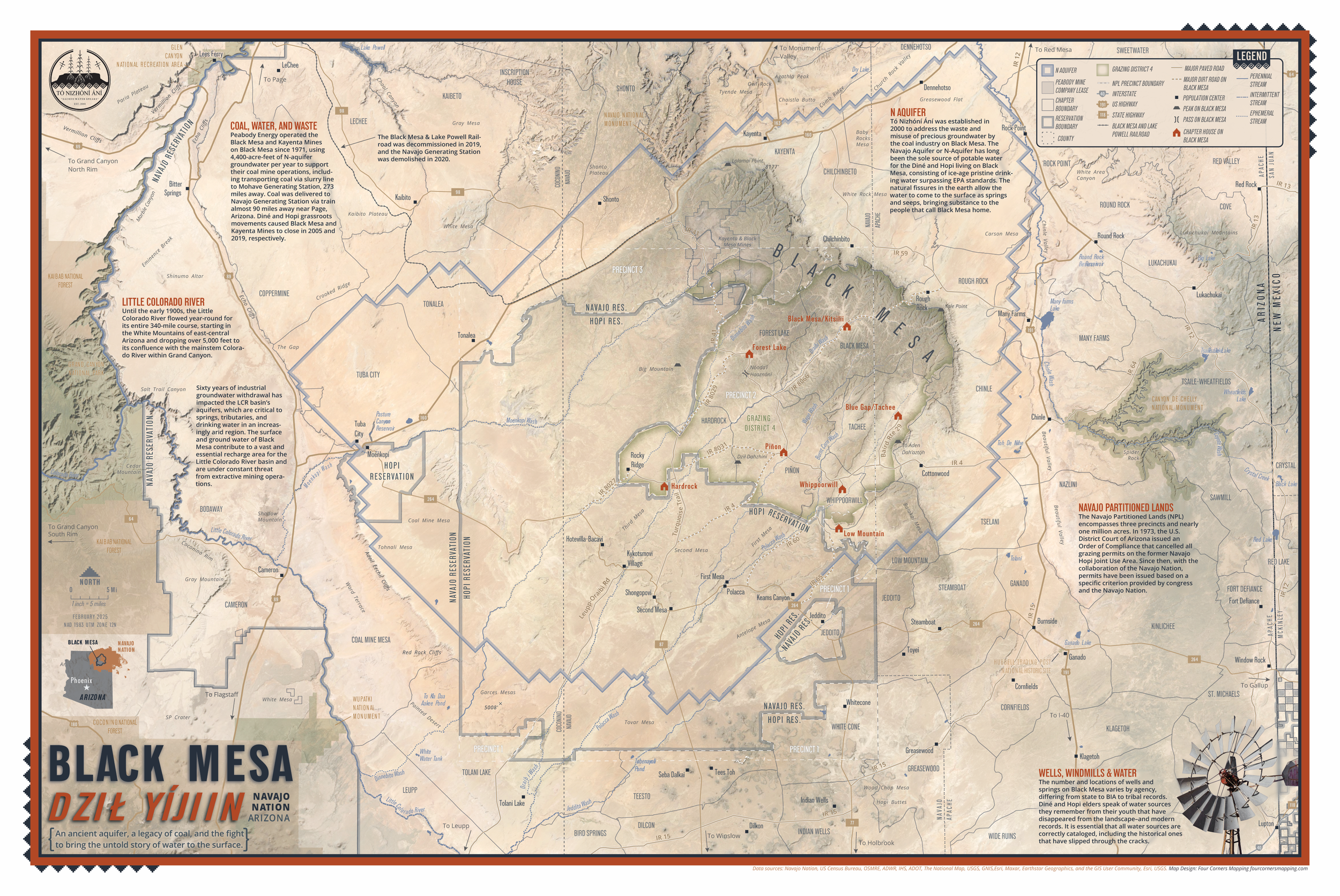
A Water Map for the Desert: Four Corners Mapping's Black Mesa Map Featured on Esri's Maps.com
I’m excited to share that my map of Black Mesa (Dził Yíjiin) is now featured on Maps.com—Esri’s curated collection of maps that inform, inspire, and dazzle.
This map was created in partnership with the Diné-led nonprofit Tó Nizhóní Ání, which works to protect the Navajo Aquifer—a critical, and often invisible, water source for communities in northeastern Arizona. The map blends detailed topography, satellite imagery, and finely crafted hydrologic symbology to bring this landscape to life.
-

Our view: Southwest Colorado drought projects must be funded
The Southwestern Water Conservation District celebrated a $25.6 million grant from the U.S. Bureau of Reclamation to address the impacts of drought on aquatic habitats in the Colorado River Basin.
The funding, the result of a broad public-private partnership, was hard-earned.
It also may be short-lived and would be a serious setback for our region.
On Monday, via a sweeping executive order titled “Unleashing American Energy,” President Donald Trump ordered federal agencies to halt funding associated with the Inflation Reduction Act, the source of the Bureau of Recreation award.
-

The Power of Maps to Influence Decisions
Anna Riling is a geologist-turned-cartographer who owns Four Corners Mapping, based in Durango, Colorado. Her business creates custom cartography for policy advocacy campaigns and print media, designs interactive web mapping applications and ArcGIS Story Maps stories, and produces geologic and topographic trail maps. In this interview, Riling talks about her move to mapmaking, her work updating the Multimodal Transportation Plan for Durango, and the power of maps in influencing decisions that matter.
Esri ArcUser, Fall 2024
-

Let our 2023 favorites inspire your 2024 storytelling
Four Corners Mapping’s StoryMap, “Caught in the Middle: A River Between Two Dams and the Future of the Grand Canyon”, was selected by the Esri StoryMaps team as one of ten favorites of 2023. From the blog: ”How does one choose story favorites from the hundreds of thousands of ArcGIS StoryMaps stories created in 2023? For every story on our list of favorites, there are hundreds of other deserving narratives. We’ve selected ten team and community stories that leverage product features and exemplify storytelling best practices.”
-

A Grand Collaboration: Telling place-based stories together for a cause
Meet Anna Riling and Sinjin Eberle, co-authors of Caught in the Middle and finalists in the 2023 ArcGIS StoryMaps Competition.
Anna, the owner of Four Corners Mapping and GIS, creates maps and place-based stories to advocate for meaningful environmental causes and protection of the natural world. Sinjin is the Southwest Communications Director with American Rivers and Executive Producer of American Rivers Media. As a child of the Southwest, Sinjin has spent the vast majority of his life in Southwestern landscapes and advocating for the protection of both land and water across the Southwest. Anna and Sinjin share a deep connection to the wildlands of the Colorado River Basin.
Learn how they — along with co-authors at AMP Insights and the Environmental Defense Fund — collaborated with scientists, Tribal leaders, historical experts, and agency officials to create a previously untold narrative around the increasing water risks to the Grand Canyon and Colorado River Basin.
Esri StoryScape, February 1, 2024
-

Mapmakers combine science and art to show us the world: Using data and creativity, cartographers create vital tools
Durango Herald, January 27, 2022
Contact me.
info@fourcornersmapping.com
(970) 903-8575
Durango, Colorado