
Geologic Trail Maps—On Your Phone!
Get the award-winning Geologic Trail Maps of the Grand Canyon on your phone with AvenzaMaps!
AvenzaMaps is a user-friendly application that enables users to view high-quality maps on their smartphones or tablets. The app utilizes GPS technology to show users their location in real time, even while offline—and on the trail!
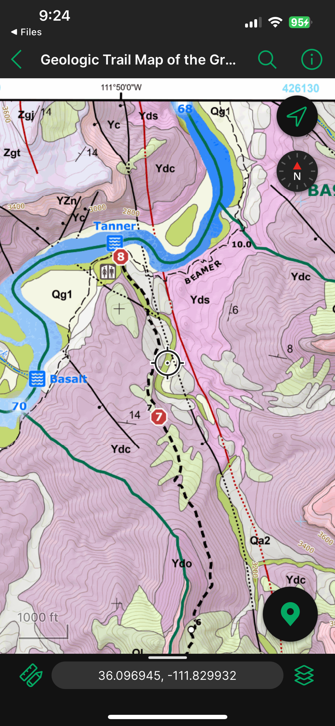
The maps highlight rock types, mineral deposits, fossils, and geological formations, providing context for each location.
With AvenzaMaps, you will always know where you are in the layer cake geology of the Grand Canyon!

Whether you are a seasoned geologist or a curious hiker, these maps enhance your journey through geologic descriptions, images, and detailed graphics exploring Grand Canyon geology and history.
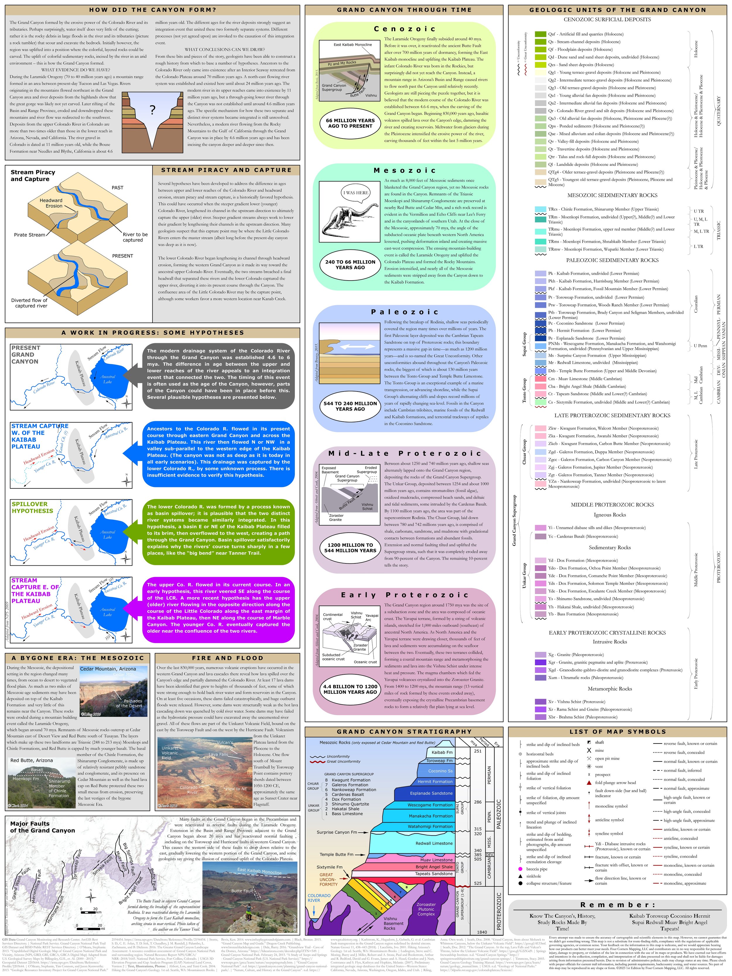
Also included is the reverse side of the physical map. It features the rock unit legend and an abundance of graphics, photos, and information about the geology of the Grand Canyon, including stratigraphic column, hypotheses regarding the formation of the Grand Canyon, the geologic eras in the Grand Canyon, the origins of the Grand Canyon’s lava flows and volcanoes, and a map of major faults.

Get the maps on AvenzaMaps!